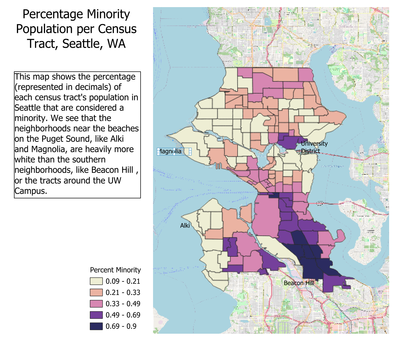
Here we have a map showing the population percentage of minorities within the boundaries of the city of Seattle. Refer to the blurb to the left of the map for more analysis and detail as to what the map shows us.
This map was made by me using the interface QGIS in March of 2024. Data comes from US Census Data from 2020.
